

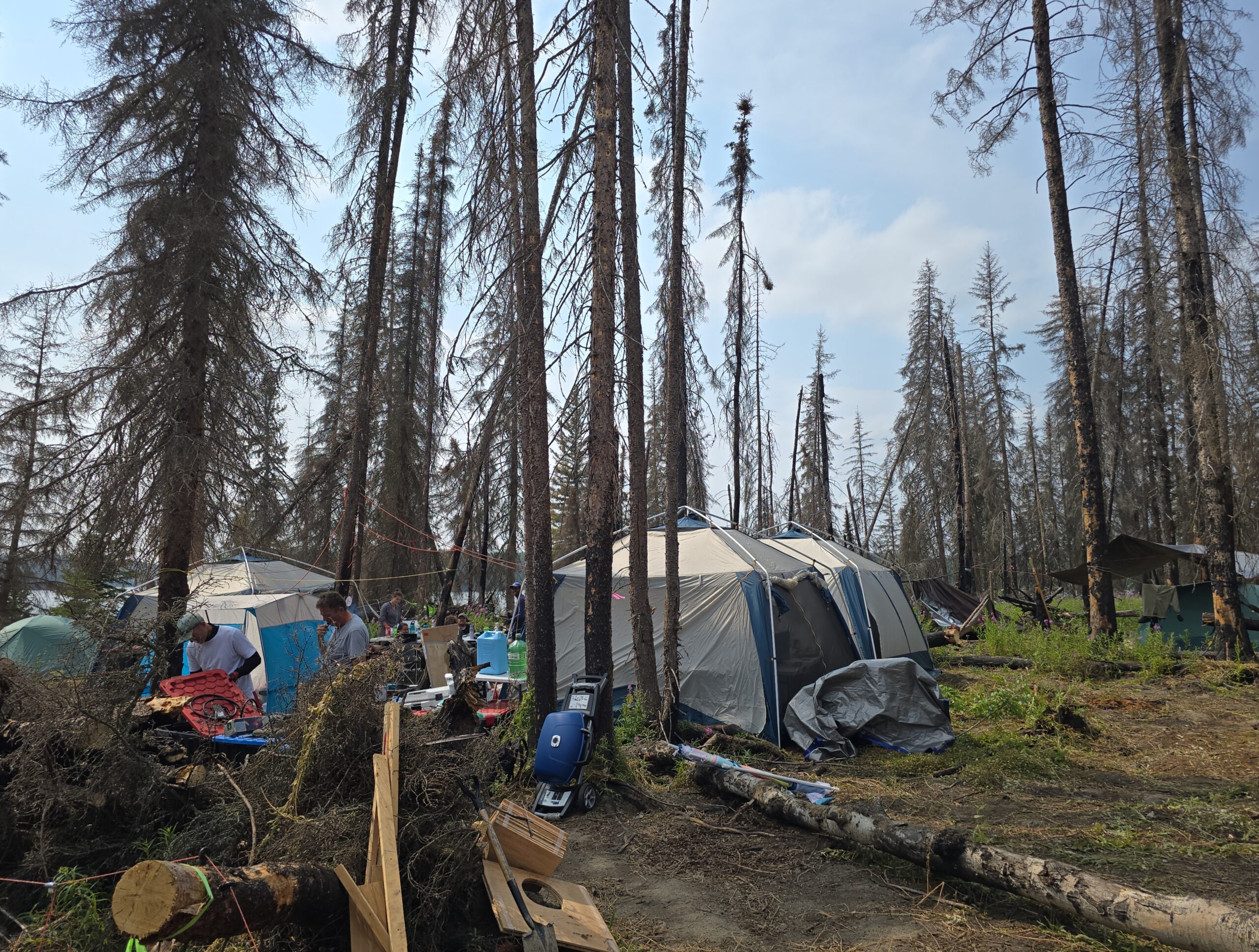
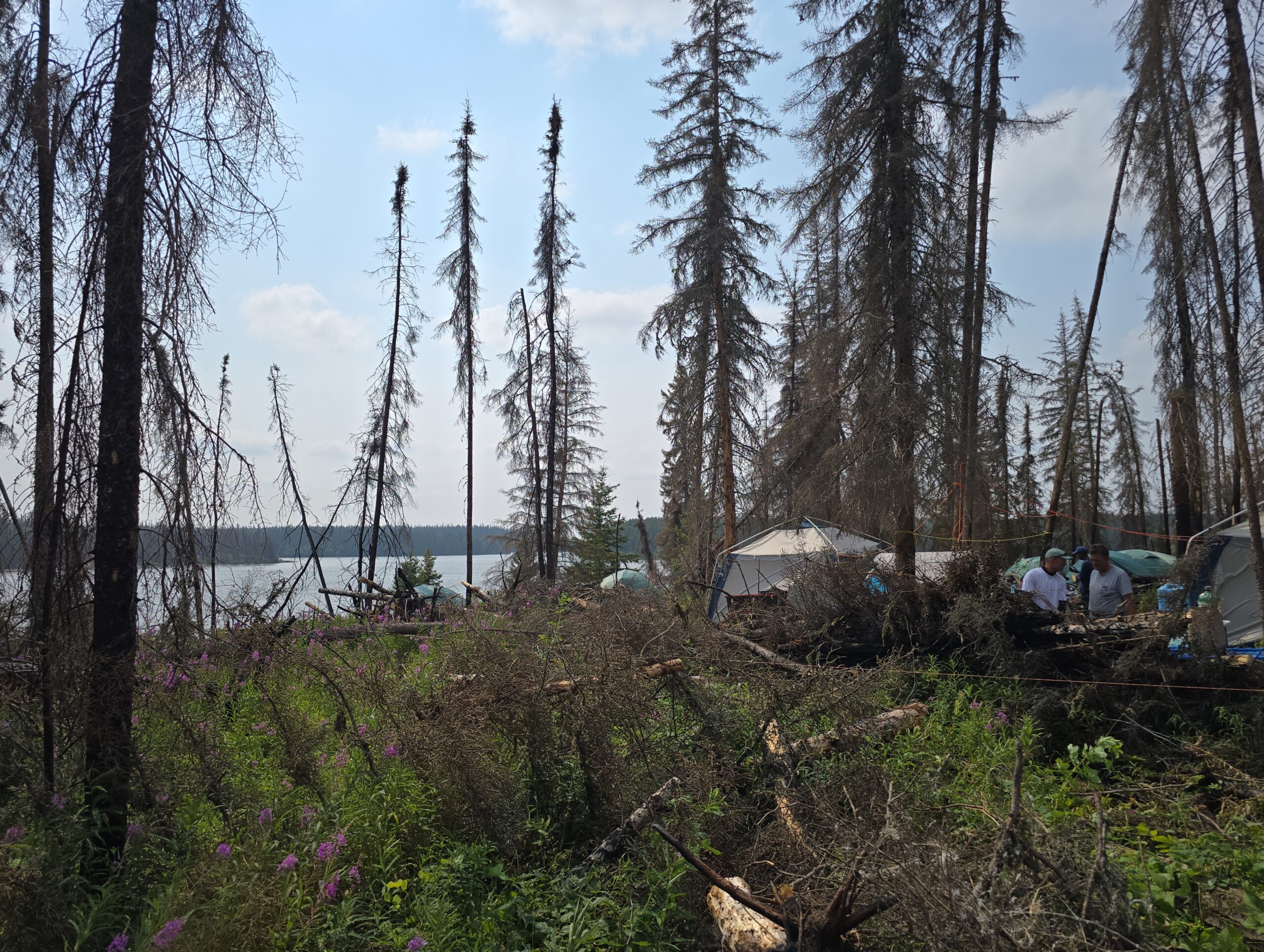
Woods Creek Project
Project Overview
- Rare earth element (REE) mineralization is believed to be associated with carbonatite dikes that intrude structurally complex zones of amphibolite-grade gneiss and schist, offering a geological setting highly prospective for REE discovery.
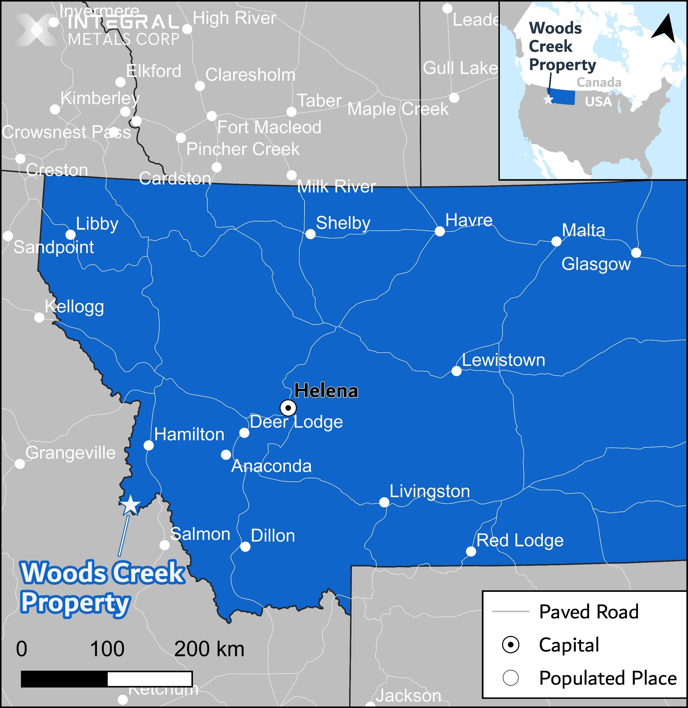
- Accessible from the town of Darby via road access. The town provides all essential services
- Located in a similar Mesoproterozoic geological units as the nearby Sheep Creek REE + Gallium project by U.S. Critical Materials. Evidence of hydrothermal activity, geological structure, and mineralization distribution support the Company's thesis of emplacement of rare metal-bearing carbonatite units at the property.
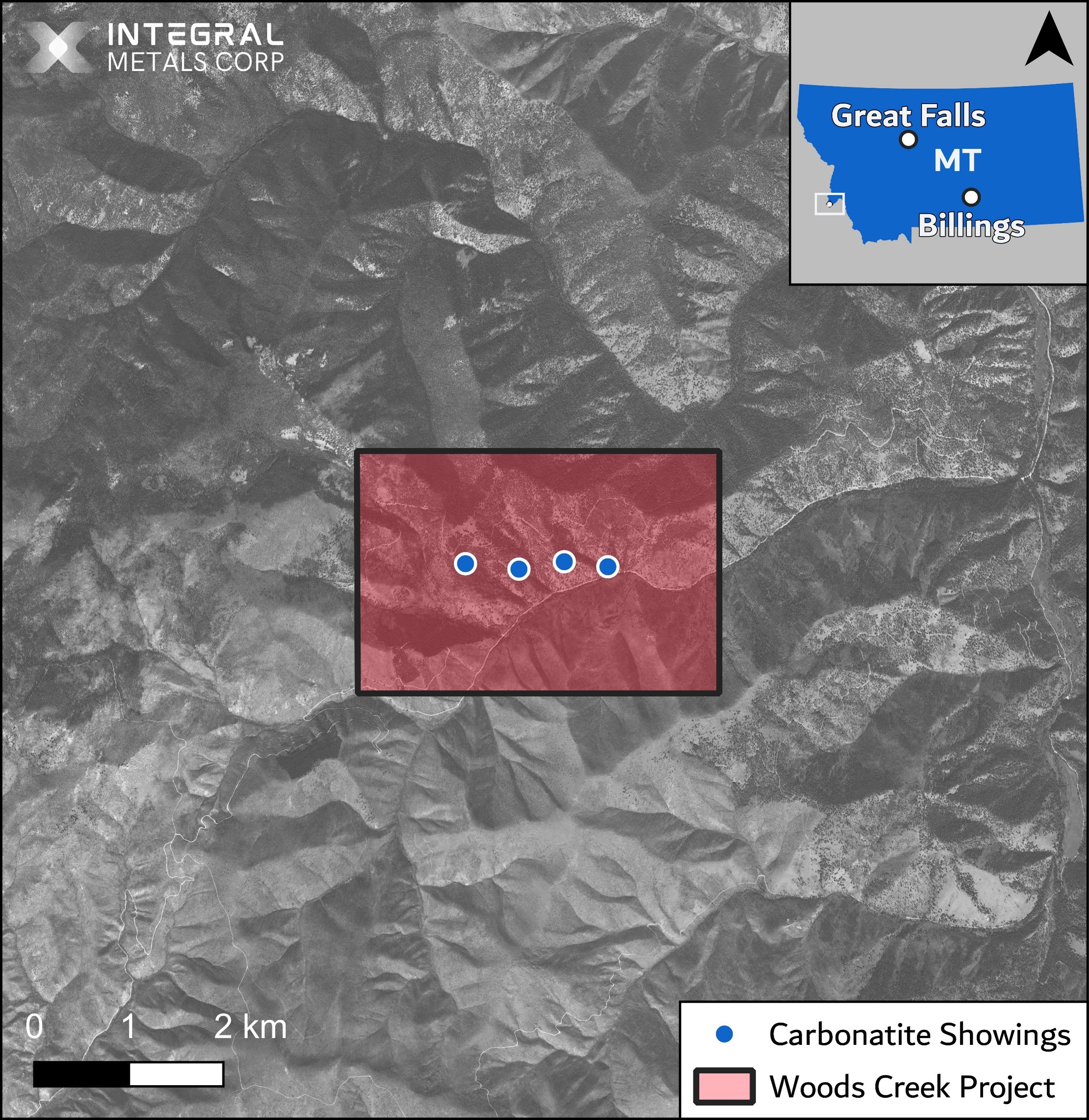
Project Location
- The project is situated approximately 70 kilometers south of Darby, MT. The location has road access via the Woods Creek Road.
- Fieldwork can be performed from May to September, and drilling can be performed year round.
- Situated on Public Land, outside of protected areas, wildlife management areas, and areas of special management.
- Located near the Sheep Creek Rare Earth Element and Gallium Project.
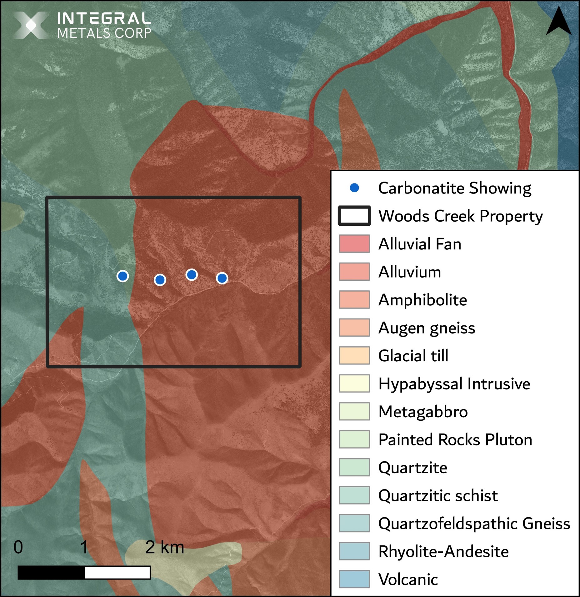
Project Geology
Location: A north-northwest trending belt that extends from North Fork to Deer Creek
Regional geology includes alkalic complexes (syenites and peridotites), which are often associated with carbonatite occurrences, as they share similar magmatic sources enriched in incompatible elements.
Hydrothermal Activity: Evidence of extensive hydrothermal alteration in the area points to fluid movement along structural weaknesses
Hydrothermal fluids can facilitate the emplacement of carbonatite by creating more space within the crust and modifying the local stress field.
Host Rocks: Mesoproterozoic metamorphic rocks including amphibolite and quartzite
Metamorphic rocks often have the competency to create sustained fracture systems that can act as conduits for migrating magmas.
Geological Structures: The area is characterized by a tectonic setting that involves significant faulting and fracturing
The presence of major north-south faults, such as the one following the West Fork of the Bitterroot River, suggests deep crustal lineaments that can serve as pathways for ascending carbonatite melts from the mantle.
Mineralized Distribution: The area shows enrichment in elements like niobium, rare earth elements, and barium
This chemical signature supports the idea that the magmatic fluids or melts that contributed to the mineralization had a composition similar to carbonatites.
Mineralization
- The are several reported showings in the Woods Creek area, including Rocky Point #1 to #5, with mineralized outcrops up to 3 meters thick.
- The REE-bearing mineral Monazite is reported throughout the showings, ranging from microscopic to coarse (8 mm) anhedral grains.
- Averaged between three samples of Monazite was reported 72% Total Rare Earth Oxide (TREO) with a 13% ratio of neodymium and praseodymium (NdPr:TREO).
- A grab sample of carbonatite collected in 2024 returned a total rare earth oxide (TREO) value of at least 70,831 ppm (7.08%), with a 14% ratio of neodymium and praseodymium (NdPr:TREO).
- Radioactivity is low and mostly attributed to negligible amounts of thorium.
Historical Work
1954: Mr. Erickson performed surface mapping
- Discovered columbite (a niobium ore mineral) in the area
1955: Mr. Van Matre performed geochemical surveying
- Further substantiated the initial discovery
1956-1957: Continental Rare Metals Corp. performed underground and surface mapping and bulk sampling
- One small test lot of ore was shipped for testing
1961: Mr. Heinrich performed mapping, geological testing, and geochemical surveying
- Identified several outcrops and evaluated mineralization potential
2023: U.S. Critical Materials performed geochemical surveying on nearby Sheep Creek
- Confirmed the presence of high-grade gallium in carbonatite ore minerals
Further Exploration Opportunties
Potential Avenues for Future Work
Magnetic and Imagery Surveys
- 3D inversion model of subsurface magnetic structures to gain insights into the geological structures that are hosting mineralization
- High-resolution imagery to detect and map exposed zones of mineralization across the property
Channel Sampling and Geologic Mapping
- Systematic channel sampling across currently exposed extents of carbonatite for further geochemical analysis, metallurgy and sorting characteristic analysis.
- Mapping and prospecting new carbonatite zones within the project area.
Development of Exploration Model
- Combining the geophysical, geochemical, biogeochemical, and geomicrobial datasets to identify overlapping anomalous areas for follow-up exploration and drill testing.